


PEE-POSH Voting District, Maricopa County, Arizona
About
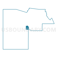
Outline

Summary
| Unique Area Identifier | 524969 |
| Name | PEE-POSH Voting District |
| County | Maricopa County |
| State | Arizona |
| Area (square miles) | 60.01 |
| Land Area (square miles) | 60.01 |
| Water Area (square miles) | 0.00 |
| % of Land Area | 99.99 |
| % of Water Area | 0.01 |
| Latitude of the Internal Point | 33.30336830 |
| Longtitude of the Internal Point | -112.25329760 |
Maps


Graphs
Select a template below for downloading or customizing gragh for PEE-POSH Voting District, Maricopa County, Arizona


Neighbors
Neighoring Voting District (by Name) Neighboring Voting District on the Map
- BULLARD Voting District, Maricopa County, AZ
- Casa Blanca Voting District, Pinal County, AZ
- CASH Voting District, Maricopa County, AZ
- KOMATKE Voting District, Maricopa County, AZ
- OHIGGINS Voting District, Maricopa County, AZ
- WARNER Voting District, Maricopa County, AZ
Top 10 Neighboring County Subdivision (by Population) Neighboring County Subdivision on the Map
- Phoenix CCD, Maricopa County, AZ (2,972,357)
- Gila Bend CCD, Maricopa County, AZ (22,116)
- Gila River CCD, Pinal County, AZ (8,771)
- St. Johns CCD, Maricopa County, AZ (2,994)
Top 10 Neighboring Place (by Population) Neighboring Place on the Map
- Phoenix city, AZ (1,445,632)
- Avondale city, AZ (76,238)
- Maricopa Colony CDP, AZ (709)
- St. Johns CDP, AZ (476)
Top 10 Neighboring Elementary School District (by Population) Neighboring Elementary School District on the Map
- Laveen Elementary District, AZ (40,902)
- Littleton Elementary District, AZ (39,076)
- Liberty Elementary District, AZ (23,944)
- Union Elementary District, AZ (14,004)
- Sacaton Elementary District, AZ (6,582)
Top 10 Neighboring Secondary School District (by Population) Neighboring Secondary School District on the Map
- Phoenix Union High School District, AZ (652,590)
- Tolleson Union High School District, AZ (164,860)
- Casa Grande Union High School District, AZ (86,739)
- Buckeye Union High School District, AZ (65,817)
Top 10 Neighboring Unified School District (by Population) Neighboring Unified School District on the Map
Top 10 Neighboring State Legislative District Lower Chamber (by Population) Neighboring State Legislative District Lower Chamber on the Map
- State House District 23, AZ (370,479)
- State House District 16, AZ (247,146)
- State House District 25, AZ (208,220)
Top 10 Neighboring State Legislative District Upper Chamber (by Population) Neighboring State Legislative District Upper Chamber on the Map
- State Senate District 23, AZ (370,479)
- State Senate District 16, AZ (247,146)
- State Senate District 25, AZ (208,220)
Top 10 Neighboring 111th Congressional District (by Population) Neighboring 111th Congressional District on the Map
Top 10 Neighboring Census Tract (by Population) Neighboring Census Tract on the Map
- Census Tract 1125.11, Maricopa County, AZ (6,816)
- Census Tract 1166.03, Maricopa County, AZ (5,736)
- Census Tract 822.04, Maricopa County, AZ (5,359)
- Census Tract 7233.04, Maricopa County, AZ (4,230)
- Census Tract 1166.08, Maricopa County, AZ (3,553)
- Census Tract 1166.09, Maricopa County, AZ (3,176)
- Census Tract 822.06, Maricopa County, AZ (3,092)
- Census Tract 9410, Maricopa County, AZ (2,931)
- Census Tract 9413, Pinal County, AZ (2,730)
- Census Tract 822.07, Maricopa County, AZ (2,394)